
GPS-DENIED NAVIGATION IN HIGH-SPEED FIXED-WING FLIGHT WITH THE ANELLO AERIAL INS
GPS-DENIED NAVIGATION IN HIGH-SPEED FIXED-WING FLIGHT WITH THE ANELLO AERIAL INS EXECUTIVE SUMMARY
EXECUTIVE SUMMARY
As crewed and autonomous aircraft increasingly operate in GPS-challenged environments, reliable navigation during signal degradation or loss becomes essential to mission continuity. This case study demonstrates the low-drift navigation performance of the ANELLO Aerial INS, built on ANELLO's Silicon Photonics Optical Gyroscope (SiPhOG™) technology, using real-world flight data from two Cessna T210 evaluations.
Both flights included pitch doublets, lazy eights, high-bank coordinated turns, and racetrack maneuvers. These test flights introduced substantial changes in pitch, roll, and heading to evaluate inertial navigation performance.
BACKGROUND
Modern airborne navigation systems rely heavily on GNSS for positioning and guidance. When signals are lost due to jamming, spoofing, or other interference, navigation must be sustained through onboard inertial sensors and available aiding sources. ANELLO conducted two fixed-wing flight tests to evaluate navigation performance during dynamic maneuvers. Recorded flight data was later analyzed without GPS position aiding to measure accumulated position drift.
MEET THE ANELLO AERIAL INS
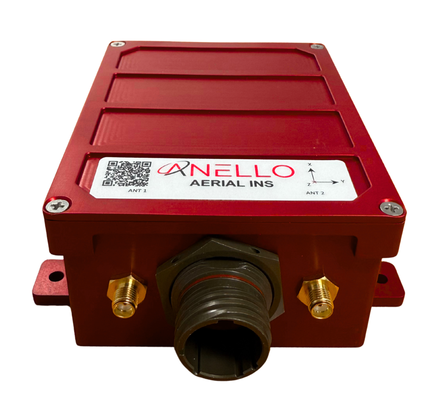
The ANELLO Aerial INS is the world’s lowest SWaP FOG-based INS, integrating the ANELLO SiPhOG™ with a tightly coupled sensor fusion architecture to minimize drift propagation for aerial platforms.
Key Specifications:
Optical gyro bias instability: <0.5°/hr
Angular random walk (ARW): <0.05°/√hr
Accelerometer bias instability / velocity random walk: 10 µg / 0.03 m/s/√hr
GNSS-aided navigation accuracy: 0.2° rms heading; 0.05° rms roll/pitch*
GNSS resilience: Dual triple-frequency receivers with heading and GNSS spoofing detection
Interfaces and timing: Ethernet, RS-232, RS-422, CAN; PPS synchronization
NAVIGATION TESTING & AIRCRAFT INTEGRATION
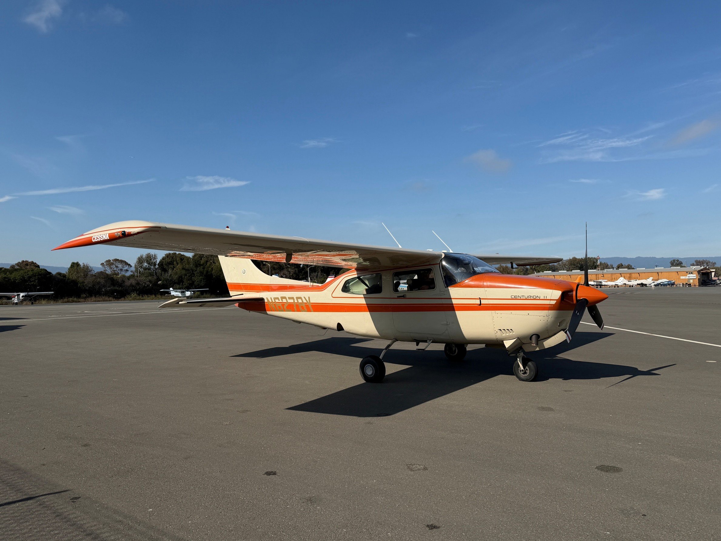
Platform: Cessna T210 fixed-wing aircraft; two flight evaluations
Navigation system: ANELLO Aerial INS with three SiPhOG™ optical gyroscopes, MEMS accelerometers, dual GNSS receivers, and advanced sensor fusion
Aiding configuration: Simulated airspeed derived from GPS groundspeed with added uniform noise
Installation: Two ANELLO navigation units were temporarily secured to the aircraft's metal cabin floor near the wing centerline.
GNSS antenna configuration: The front Aerial INS used dual GNSS antennas positioned on opposite sides of the front dashboard. A second ANELLO unit, running Aerial INS software, used antennas positioned near the rear windshield to evaluate alternative antenna placements.
Airspeed: For these tests, the Aerial INS was not connected to the aircraft's certified air-data computer. Simulated airspeed aiding was therefore used during post-processing.
An artificial airspeed was created for simulation purposes from the GNSS velocity. The velocity was turned into a speed, degraded the measurement precision, and added a uniform noise to the result.
Evaluation: Complete sensor data was logged during the flight. Flight data was reprocessed without GPS position aiding for flight segments to simulate GPS-denied navigation performance. All reported navigation performance results were obtained from the front ANELLO Aerial INS unit.
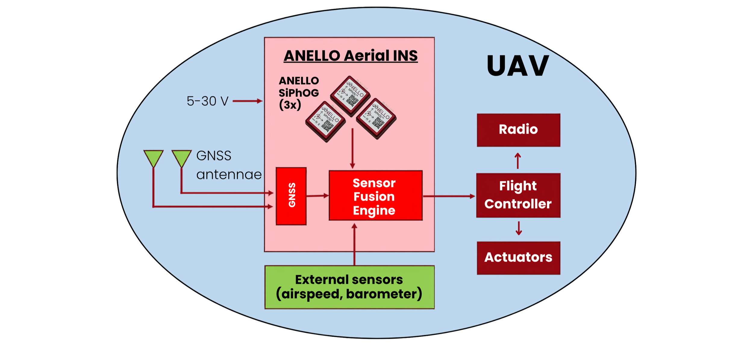
Figure 1: ANELLO Aerial INS - Illustrative navigation and flight-control architecture
TEST METHODOLOGY
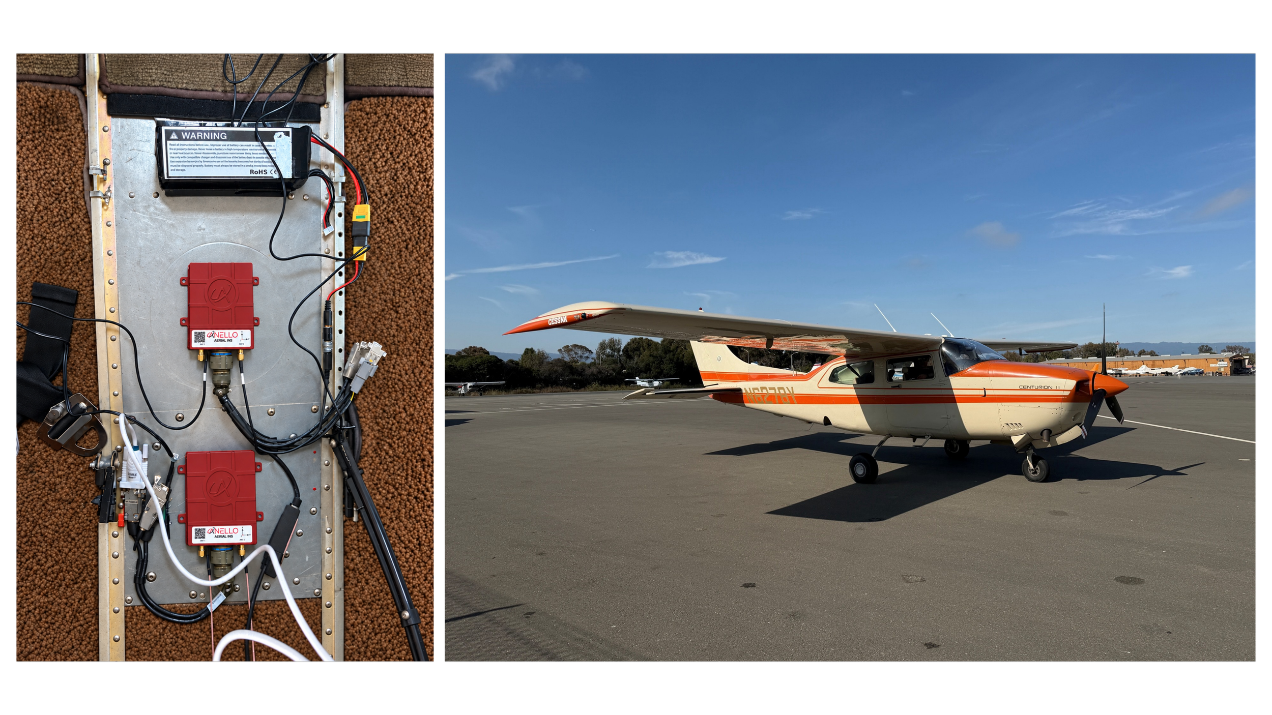
Figure 2: ANELLO Aerial INS flight-test installation (left).
Figure 3: Cessna T210 aircraft used for flight evaluations (right).
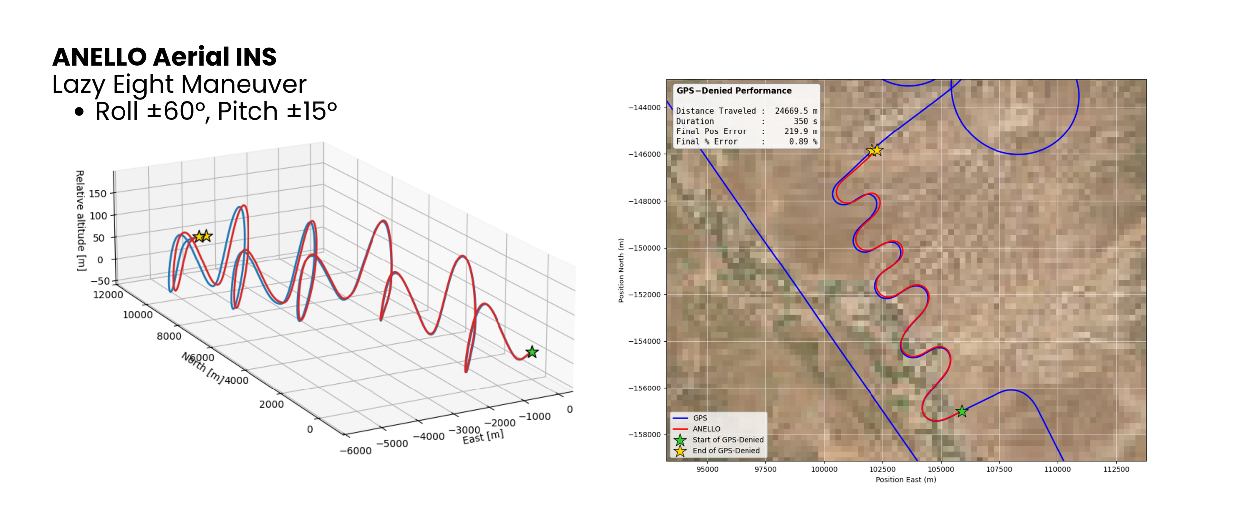
Figure 4a: ANELLO Aerial INS lazy-eight maneuvers showing the 3D flight trajectory, comparing GPS reference (blue) and GPS-denied Aerial INS navigation (red).
Figure 4b: Overhead view of the lazy-eight maneuvers showing the GPS reference trajectory (blue) and GPS-denied Aerial INS solution (red).
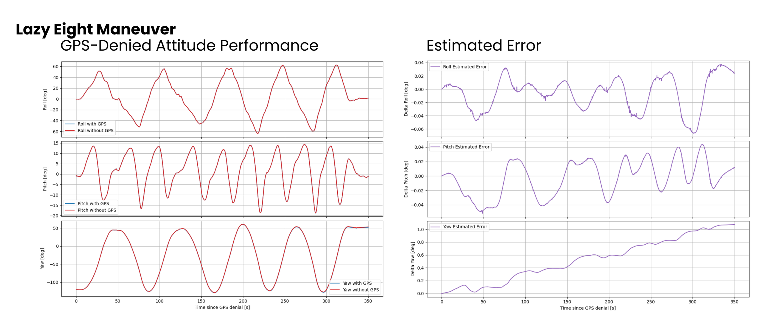
Figure 5a: ANELLO Aerial INS attitude performance during the lazy-eight maneuver, comparing GPS-aided (blue) and post-processed GPS-denied (red) roll, pitch, and yaw estimates.
Figure 5b: ANELLO Aerial INS estimated attitude differences during the GPS-denied lazy-eight maneuver, demonstrating RMS errors of 0.026° in roll, 0.024° in pitch, and 0.627° in yaw relative to the GPS-aided solution.
Two Cessna T210 flights covered distances of 304 km and 460 km. Maximum speeds reached 182 and 190 knots, respectively. Both flights included complex maneuvers designed to characterize navigation performance under dynamic airborne conditions:
Pitch doublets: Pitch changes of approximately ±20°
Lazy eights: Roll angles reaching ±60° and pitch angles of ±15°
Coordinated turns: Shallow, medium, and high-bank turns reaching ±45° roll
Racetrack procedures: Repeated turns at approximately 30° roll
RESULTS
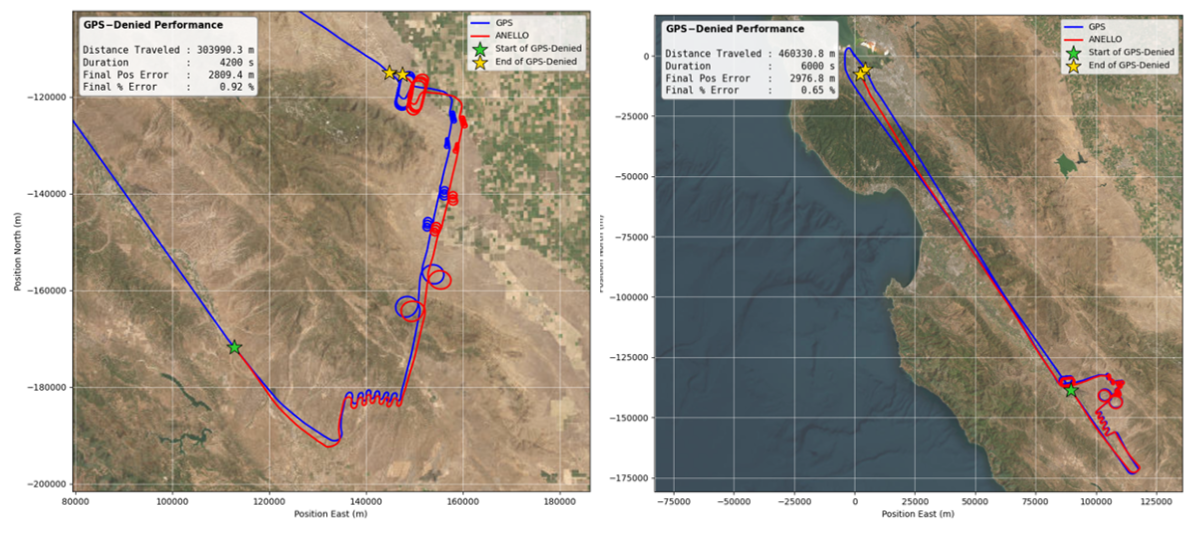
Figure 6: Post-processed GPS-denied flight trajectory, 304 km evaluation (left).
Figure 7: Post-processed GPS-denied flight trajectory, 460 km evaluation (right).
The ANELLO Aerial INS demonstrated low-drift navigation performance across both evaluations:
304 km flight: Final position error of 2.81 km, equivalent to 0.92% of distance traveled
460 km flight: Final position error of 2.98 km, equivalent to 0.65% of distance traveled
Dynamic maneuver performance: Recorded attitude-disagreement measurements captured navigation behavior during pitch doublets, lazy eights, coordinated turns, and racetrack procedures
Both evaluations achieved less than 1% final position error relative to total distance traveled under the post-processed GPS-denied configuration.
CONCLUSION & NEXT STEPS
These fixed-wing flight evaluations demonstrate the ANELLO Aerial INS's low-drift navigation performance using real-world flight data analyzed under simulated GPS-denied conditions. Through integration of the ANELLO SiPhOG™ with advanced sensor fusion and speed aiding, the ANELLO Aerial INS enables precise, low-drift navigation when GPS is degraded or unavailable. The ANELLO Aerial INS allows customers to convert existing airframes into mission-ready, GPS-denied platforms.
Interested in integrating with the ANELLO Aerial INS or running a pilot?
Contact info@anellophotonics.com to discuss interfaces, drivers, and evaluation units.